CNN —
This year’s Atlantic hurricane season is expected to be near average, officials with the National Oceanic and Atmospheric Administration said Thursday.
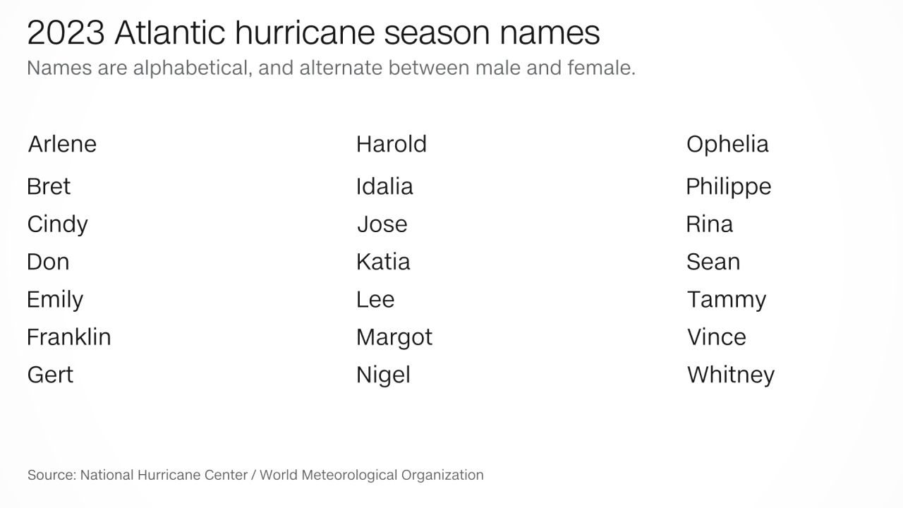
Forecasters at the agency are predicting 12 to 17 named tropical storms, five to nine of which could become hurricanes. They expect as many of four of those could strengthen into major hurricanes – category 3 or stronger.
The last time there was fewer than the average of 14 named storms was in 2015. Hurricane season technically begins June 1, though storms have developed before that date in the past.
“As we saw with Hurricane Ian, it only takes one hurricane to cause widespread devastation and upend lives. So regardless of the number of storms predicted this season, it is critical that everyone understand their risk and heed the warnings of state and local officials,” FEMA Administrator Deanne Criswell said at a news conference. “Whether you live on the coast or further inland, hurricanes can cause serious impacts to everybody in their path.”
This hurricane season’s activity will largely depend on two competing factors: El Niño, which inhibits storm development, and near record-high ocean temperatures, which will help fuel hurricanes.
The El Niño-Southern Oscillation is a naturally occurring climate pattern impacting the ocean and atmosphere in the tropical Pacific, and consists of opposite phases known as El Niño (the warm phase) and La Niña (the cool phase). It has the potential to significantly impact global weather patterns and its phase (El Niño, La Niña or neutral) is one of the primary “knobs” that controls hurricane activity in the Atlantic and Pacific basins.
El Niño is characterized by warmer-than-average sea surface temperatures in the tropical Pacific Ocean, and tends to increase upper-level winds over the Atlantic, which disrupt and suppress hurricane formation.
El Niño’s influence on this season is still somewhat uncertain because it is only just beginning to develop. That it will eventually form this year is a “foregone conclusion,” said Phil Klotzbach, a research scientist in the Department of Atmospheric Science at Colorado State University, who was not involved in the NOAA outlook.
But there’s another factor that could negate or even outweigh El Niño’s influence this year: Sea surface temperatures in the Atlantic Ocean are already at or near record-high levels, and in a way that “matches up quite well with what we associate with active Atlantic hurricane seasons,” Klotzbach told CNN.
“If these warm anomalies in the North Atlantic persist through the hurricane season, it has the potential to cause less of an El Nino (wind) shear impact than we normally see,” he said, and that possibility is even showing up in “several climate model forecasts” for the summer and fall.

Hurricanes are natural phenomena shaped by complex atmospheric and oceanic dynamics. But they are now increasingly influenced by human-caused climate change.
As our planet continues to warm due to fossil fuel pollution, the impacts are manifesting in the intensification and altered behavior of these destructive storms. Through a combination of warmer waters, increased atmospheric moisture and rising sea levels, the climate crisis has set the stage for hurricanes to pose unprecedented risks to coastal communities.
If recent history is any indication, the US will face the threat of a high-end landfalling hurricane this season. There have been six category 4 or 5 hurricanes to hit the mainland since 2017, the most ever during a six-year period. Climate change, especially the buildup of heat increasing the ocean’s temperature, is leading to a larger percentage of hurricanes reaching the highest categories on the scale – a trend that is likely to continue as global temperatures climb.
The key difference between tropical depressions, tropical storms and hurricanes lies in their wind speeds and the level of organization within the system.
While a tropical depression represents the earliest stage of cyclone development, named tropical storms exhibit more structure and stronger winds. Hurricanes — the most powerful and dangerous of the three — possess the strongest winds and a well-defined eye, making them capable of causing extensive damage over large areas.
